We will survey all accessible floors in the property and provide plans showing all visible walls, windows, doors, spot height levels, ceiling/roof heights, window sill/head heights.

Call 0333 335 5085 or send us a message
A measured building survey accurately records an existing building’s dimensions, layout and structural features to produce floor plans, elevations, sections, 2D CAD drawings, Revit BIM models and registered point cloud data for planning, design, refurbishment and construction projects.
At XP Surveys, our measured building surveys are delivered to ±2mm accuracy using industry-leading Trimble X9 & X7 and Leica RTC360 3D laser scanners. Our surveys produce verified, coordinated deliverables ready for immediate use by architects, developers, engineers, commercial property owners and homeowners across the UK.
Using High-Definition Surveying (HDS), our scanners capture millions of measurement points every second, accurately recording a building’s geometry, structure and spatial layout. The resulting registered point cloud provides a reliable existing-condition record that reduces project risk, minimises unnecessary return site visits and supports confident planning, design development and technical coordination throughout the project lifecycle.

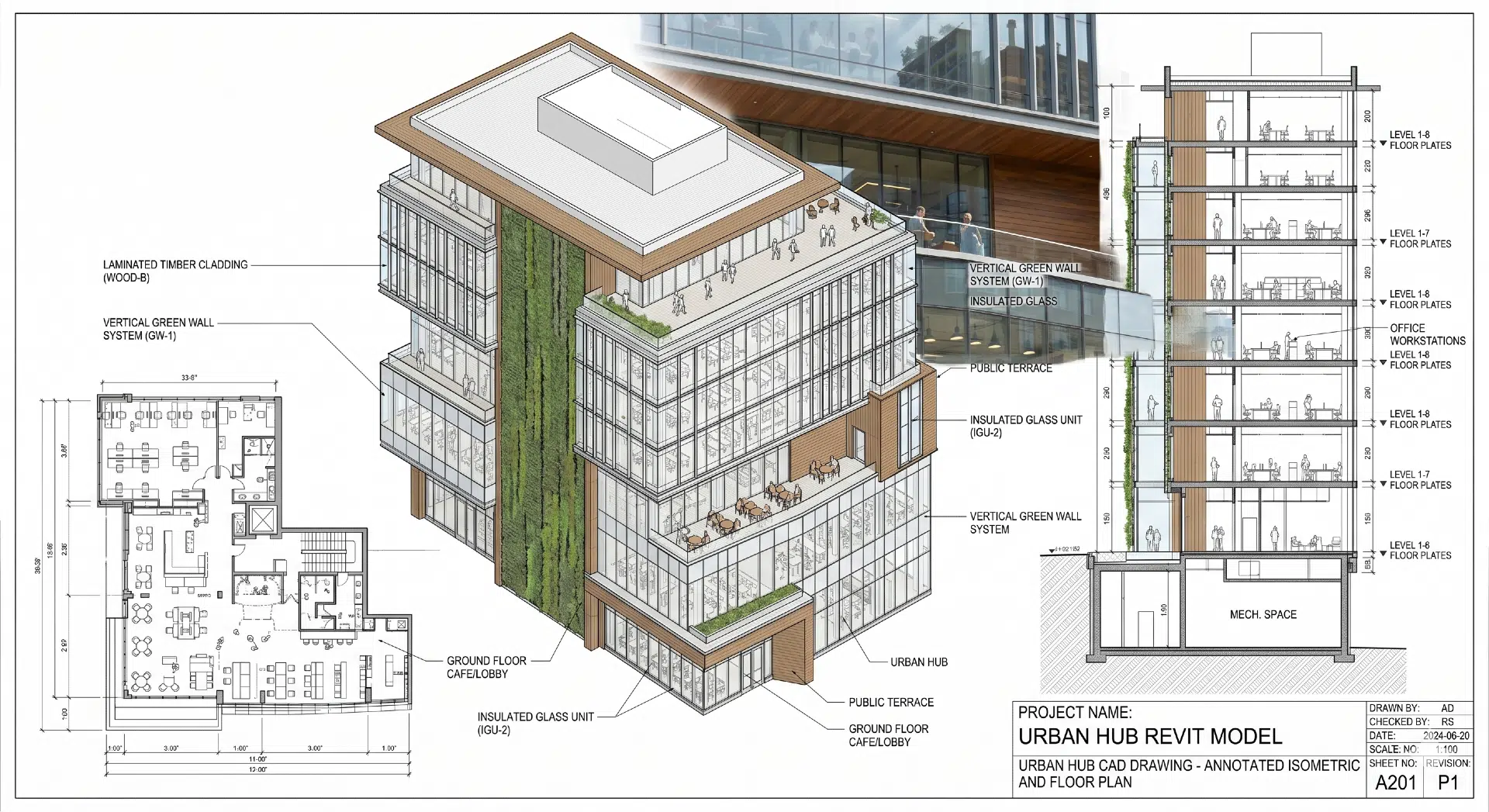
From residential extensions, loft conversions and listed buildings to commercial developments, industrial facilities and complex multi-storey projects, each measured survey delivers coordinated CAD and BIM outputs tailored to the required level of detail.
Our measured surveys support planning applications, refurbishment schemes, listed building consent, commercial lease analysis (GIA/NIA), asset management and detailed design coordination.
Reliable, highly accurate survey data forms the foundation of every successful design project. Whether working on a private home, commercial property, constrained urban site, complex multi-storey development or sensitive heritage building, XP Surveys delivers survey-grade information that helps architects, engineers, contractors and project teams work more accurately, efficiently and with fewer unnecessary return visits.
Trusted by Architects & Developers
★★★★★
“I have found incredible flexibility and helpfulness in the XP Surveys team. In my last 10 professional years, I have rarely found a business, surveyors or otherwise, to be as useful, approachable and competitive as them. It helps provide confidence to myself and my clients alike.”
Ryan Godfrey – Director and Founder, Elements Architectural
“XP Surveys has been a long standing partner for measured surveys on our residential projects. The team ensure projects are accurately measured and drawings delivered in a timely manner. Their app system gives real-time progress of the survey and when the drawings will be available, enabling us to schedule and programme our work effectively.”
James Lai – JLArchitecture Ltd
“I have worked with XP Surveys on about a dozen projects. I chose them for their architectural background, and that has proved a great benefit. The consultation service lets us have an informed conversation so they can tailor the survey to my exact requirements. Compared to other companies I have used, I get a bespoke service that saves me time and effort. Working with them is always smooth, efficient and pleasant.”
Anne Owen – Anne Owen Architects
See how 3D laser scanning captures a building and transforms it into survey-grade CAD and BIM deliverables.

Our surveyors use the latest Trimble X9 and X7 scanners alongside the Leica RTC360 3D laser scanners to capture millions of highly accurate measurement points every second, creating a precise digital record of existing buildings. This survey data supports planning applications, refurbishment, conservation projects, design coordination, asset management and construction across residential, commercial and heritage properties.
Every project begins with High-Definition Surveying (HDS) to capture a building’s geometry, structural features and spatial layout. The registered point cloud is processed into coordinated deliverables, including floor plans, elevations, sections, 2D CAD drawings and Revit BIM models, providing a complete and accurate digital record of the property.
All survey information is referenced to a common control framework, ensuring consistency across every drawing and model. Architects, engineers and contractors can extract additional dimensions directly from the registered point cloud without repeat site visits, improving technical coordination, reducing project risk and supporting efficient design development throughout the project lifecycle.
The as-built documentation can be tailored to suit different project requirements, depending on the level of detail needed and how the survey data will be used. Selecting the right survey type ensures architects, developers and contractors receive accurate existing-condition information that supports confident planning, design and construction decisions.
From basic floor plans through to detailed laser scanning and BIM-ready outputs, our building measured surveys provide flexible solutions for residential and commercial projects of all sizes.
| Measurement Types | Description | Use Case |
|---|---|---|
| Basic Floor Plan | Essential internal layouts showing wall positions, openings, room dimensions and key structural elements. | Ideal for renovations, layouts and early design stages. |
| Elevational | Detailed measurements of building façades, including windows, doors, rooflines and architectural features. | Commonly used for planning applications and façade works. |
| Internal and External Elevation | Comprehensive documentation of both exterior surfaces and internal structural features, such as beams and columns. | Suitable for refurbishments and heritage projects. |
| Detailed Data Survey | Enhanced survey detail including fixtures, fittings and internal building elements where required. | Best for complex refurbishments or technical design stages. |
| 3D Laser Scanning | High-density point cloud capture used to create precise 3D models and BIM deliverables. | Ideal for complex structures and high-accuracy projects. |
| External Site & Context Surveys | Mapping of surrounding land and external features to complement building survey data. | Used when extensions or landscape changes are involved. |
As-built drawings provide architects, engineers and planners with the information required to move projects forward with confidence. The level of detail is tailored to suit each project, ensuring coordinated survey information throughout the design and construction process.
Fast laser scan surveys provide architects with dependable existing-building information from the outset. Using advanced laser scanning and BIM-ready workflows, we capture high-density point cloud information that integrates seamlessly into Revit and CAD environments – helping design teams save time, reduce risk and maintain consistency throughout the project lifecycle.
Architects, developers and contractors rely on measured building survey information to support confident design and construction decisions. Incomplete or outdated existing-condition drawings can lead to delays, coordination issues and unnecessary project costs.
Every survey is delivered in the formats your team needs – including 2D CAD drawings in AutoCAD (.dwg), 3D Revit BIM models, ArchiCAD-compatible files and raw point cloud data (.rcp/.e57). Outputs integrate directly into existing architectural and construction workflows without additional processing.
This allows architects, engineers and contractors to work from coordinated building information throughout design development, technical coordination and project delivery.

CAD-ready outputs can be delivered in as little as 7 days. We use industry-leading equipment, including the Trimble X9 & X7 and Leica RTC360, to capture detailed building information to ±2mm accuracy, with clear fixed pricing and no hidden fees. We can provide a faster turnaround as a paid option when deadlines are tight.
What you get:
Trusted by architects, developers, engineers and property professionals across the UK. Learn more about our survey equipment or get an instant online quote for your project.

A measured building survey is typically used when accurate existing-building drawings are needed for planning, refurbishment, extensions, structural alterations or ongoing building management.
CAD/BIM deliverables are required at various stages of property development and management to ensure accurate planning and execution. The specific instances when an existing measured survey is required to improve accuracy include:
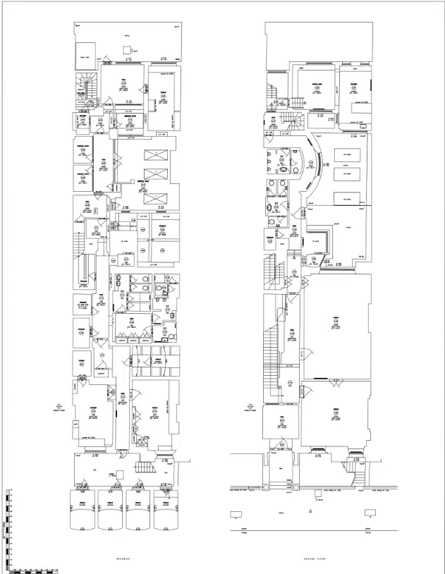
As-built precise building measurements are vital throughout the lifecycle of a property, from initial planning to ongoing maintenance, providing accurate data that supports informed decision-making and project success.
The cost depends on property size, complexity, access, level of detail and required outputs such as CAD drawings or BIM models.
Measured survey costs vary significantly depending on project scope – a standard 2–3 bed house costs far less than a multi-storey commercial building.
At XP Surveys, pricing is transparent and straightforward, with no hidden fees or vague estimates. Final costs are based on the scale of the property, accessibility, required level of detail and the type of deliverables needed for your project.
Here’s what you can expect:
| Property Type | Typical Cost (From) |
| Small / limited-scope survey (selected areas only) | From £250 + VAT |
| Studio – 1 Bed (Standard) | £750 – £900 + VAT |
| 2–3 Bed House (Standard) | £900 – £1500 + VAT |
| 4–5 Bed House (Incl. Loft/Sections) | £1500 – £2500 + VAT |
| Large Properties/Commercial | Individually quoted based on scope |
These estimates cover on-site data capture and delivery of 2D CAD-ready drawings. All pricing includes measurements to within ±2mm accuracy.
Your final measured building survey cost in the UK depends on several key factors:
Tip: Clearly define your scope upfront to avoid extra site visits and unexpected charges.
Use our online quote tool to receive a fixed quotation based on your property’s size and required deliverables.
A measured building survey provides essential documentation and survey information for architectural, engineering and construction projects. Our deliverables are tailored to your project, ensuring you receive accurate drawings and data aligned with your design and planning requirements. Here’s what you can expect:
Deliverables are supplied in commonly used CAD and digital formats to support professional design workflows. Output type and format are agreed in advance to ensure compatibility with your team’s requirements, and can be integrated directly into BIM environments for a more dynamic design and management process. We provide data in the format your team needs for immediate use:
Survey Control: Measured surveys are referenced to an established control framework, keeping drawings consistent across multi-storey buildings.
2D CAD drawings generated from laser scan data, produced to professional survey standards. Deliverables can include room dimensions, structural features, openings and internal fittings as required, typically produced at scales ranging from 1:50 to 1:200.

XP Surveys works on projects across the UK, providing accurate survey information for a wide range of property types to support design, planning, refurbishment and construction. These recent projects demonstrate the different environments, survey requirements and deliverables our team regularly works with.
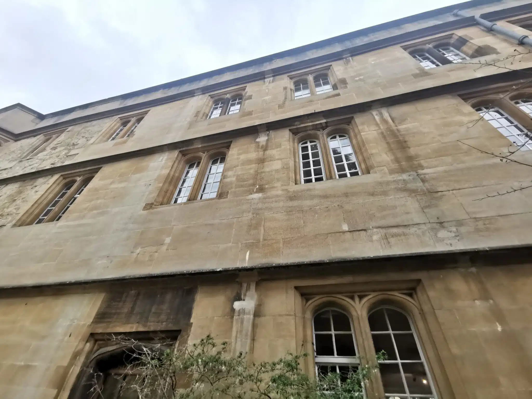
XP Surveys completed a measured and topographical survey at Exeter College, recording the building and surrounding site. The work included floor plans, levels, ceiling and roof heights, elevations and a cross-section to support future design, planning and coordination.
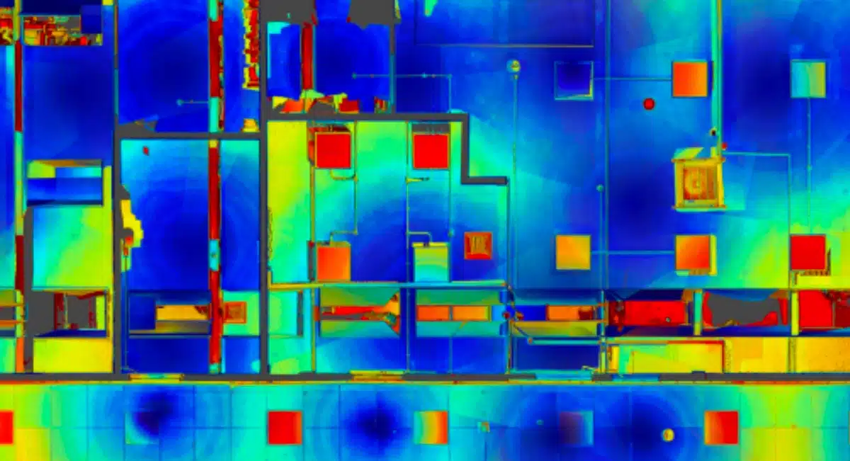
A high-precision survey was carried out within the Pathology Laboratory at Wexham Park Hospital to support the installation of new analytical and automation equipment. 3D laser scanning captured detailed floor-level information for installation and construction coordination.

XP Surveys captured the existing Greenpeace UK headquarters and produced accurate 2D CAD drawings together with a detailed 3D Revit model, providing reliable building information for architectural design and project coordination.
A measured survey is the professional process of recording the dimensions, layout and structural features of an existing building or site. The result is a set of verified drawings – typically floor plans, elevations and sections – used to support planning applications, refurbishments, extensions and construction projects.
Measured building surveys range from basic floor plans to advanced 3D laser scanning and BIM-ready outputs, depending on project requirements. They provide architects, designers and construction teams with reliable existing-condition information before design work begins.
3D laser scanning allows surveyors to capture complex buildings and structural details quickly and efficiently. The process reduces the need for repeat site visits while supporting accurate floor plans, elevations, sections and technical documentation.
Laser scanning also creates detailed point cloud information that can support CAD drawings, BIM workflows and refurbishment projects.
On-site survey times depend on the size, complexity and level of detail required. Smaller residential properties may take a few hours on-site, while larger buildings or surveys including elevations, sections and laser scanning can take several days. Finished CAD deliverables are then issued within our standard turnaround time.
A point cloud is a digital collection of measured points captured using 3D laser scanning technology, creating a detailed representation of a building or site.
Point cloud information can be used to support CAD drawings, BIM modelling and technical coordination workflows. Explore our point cloud survey services.
Many planning applications require accurate existing-condition drawings before proposals can be assessed. A measured building survey is a reliable way to produce the floor plans, elevations and sections that architects use to prepare planning drawings, giving the planning authority a verified record of the current building.
We’re looking forward to hearing from you and helping you achieve the best results from your measured survey.
We work all over the United Kingdom. Get an instant online quote for your property’s precise data for projects nationwide. For architectural projects requiring detailed as-built drawings, view our instant quote calculator.


We will survey all accessible floors in the property and provide plans showing all visible walls, windows, doors, spot height levels, ceiling/roof heights, window sill/head heights.

We will survey all accessible and visible sides of the property and provide elevation drawings showing the building outline, ridge/eaves heights, all external distinguishing elements such as windows, doors, rainwater pipes and other detailing. We will also include the outline of buildings within 3m of the host building.

Provided where our equipment has full visibility of the roof lines from ground level, we will note any estimated roof details on our drawings.

These are 'cut-through' cross-sectional drawings showing wall and floor details.
Select a topographical survey level to find out more.

Will include the visible boundary outline only together with immediate ground levels around any buildings, and visible drainage cover location/levels.

This topo will include the visible boundary outline, all key features and immediate ground levels within 3m of any buildings, and visible drainage cover location/levels.

Will include boundaries (including type and heights), building OUTLINES, adjoining buildings, trees / groups of trees (including trunk diameter, spread, height) (any diameter above 150mm would be shown), hardstanding, walls, fences, hedges, flowerbeds, kerblines, verges, manhole / service covers (including cover level), etc. plus all other visible salient features of the area.
We use Area data from your property's EPC certificate and the UK Ordnance Survey database to calculate your quote estimate. If there is not enough data in the UK database we cannot provide an instant quote, but one of our team will be able to provide a formal written quote by email within 48 working hours. If the database holds incorrect data on your property you will still be provided an estimate, but our fee is subject to change to suit the actual size of your property
Your chosen outputs:
"I have found incredible flexibility and helpfulness in the XP Surveys team. In my last 10 professional years, I have rarely found a business, surveyors or otherwise, to be as useful, approachable and competitive as them. It helps provide confidence to myself and my clients alike."

A member of the XP Surveys team will be in touch shortly
Or call 0333 335 5085
Or call 0333 335 5085
Or call 0333 335 5085