We will survey all accessible floors in the property and provide plans showing all visible walls, windows, doors, spot height levels, ceiling/roof heights, window sill/head heights.

Call 0333 335 5085 or send us a message

XP Surveys are a team of experienced land surveyors working across Greater London and the Home Counties: Berkshire, Buckinghamshire, Essex, Hertfordshire, Kent, Middlesex, Oxfordshire, Surrey, and Sussex.
We are known in the property development and architecture profession for our detail, accuracy, and rapid turn-around of topographical and other site surveys.
If you’re looking for a quote for topo surveys today, hit the Contact Us button below or use our Instant Quote Tool to the right.

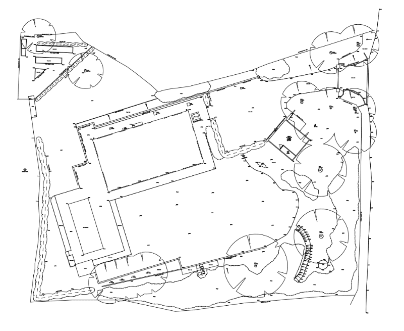
A topographical survey (also called a topographic survey) is a detailed and accurate representation of the physical features of a site. It shows the positions, levels, and contours of both natural and man-made elements, such as buildings, trees, boundaries, fences, paths, utilities, and land gradients.
Using high-precision surveying equipment, XP Surveys captures all relevant ground-level details to create a scaled digital map or CAD file. This is essential information for architects, developers, engineers, and planners before any construction or land development work begins.
We specialise in delivering high-accuracy topographical surveys for projects across London and the Home Counties. Whether you’re planning a new build, infrastructure development, or landscape design, our detailed site data ensures your project starts on solid ground.
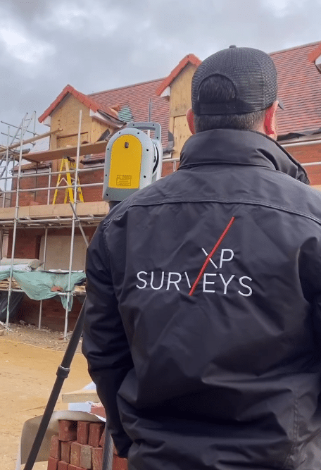
Each topographic survey we conduct is tailored to your site and design brief. We record land contours, levels, boundaries, trees, drainage features, man-made structures, and underground services using state-of-the-art equipment such as the Trimble X7 Laser Scanner and Leica TS16 Total Station.
Our surveys are widely used by:
We offer flexible deliverables, including 2D CAD drawings, 3D topographic models, and Revit-compatible formats, to suit your workflow.
Whether you need a full site survey or a focused topo survey of a specific area, our experienced team ensures you receive the clarity and precision needed to move forward confidently.

A topographical survey is useful for architects, engineers and developers as they can assess the potential of the land and plan property developments that take into consideration any technical or planning limitations, and mitigate any potential risks.
On a construction site, a topological survey shows detail such as where earthworks need to be removed or added, where flood prevention measures are required, where existing underground utilities are located and where trees need to be retained and protected.
A topographical survey can also help home and landowners accurately calculate the value of the property or land by accurately providing the size/area.
Topographical surveys play a critical role in a wide range of planning, design, and construction projects. By capturing precise land data, these surveys allow architects, developers, and engineers to make informed decisions early in the project lifecycle.
Common applications include:

We use the latest technology to accurately capture land data and features — this includes the Trimble X7 3D Laser Scanner and the Leica TS16.
Knowing the vital accuracy and detail needed by architects, our experienced surveyors use the best equipment available. Read more in our insight to the Topo survey equipment we use.
Just let us know what program you or your architect works in and we will supply you with your survey drawings in the desired format including 2D AutoCAD, Revit and ArchiCAD.
To carry out a topographical survey, the site is visited by a land surveyor who sets up specialised measuring equipment. Accurate to within 2mm, this technology records the heights and distances between land features, giving the surveying team the coordinates and data required to create a complex map of the land. At XP Surveys, this is created using specialist CAD technology that can output the map in AutoCAD (.dwg), Revit (.rvt) or portable document format (.pdf).

As you can imagine, every piece of land is unique, so each topographical survey is a bespoke project. The size of the land and the number and type of natural and artificial features it contains will influence the cost as this increases the time it takes to measure, record and map.
Topo Surveyors generally work on an hourly rate for their on-site work plus a fee for producing the drawings. At XP Surveys our Topographical Survey costs are based on the size of the area surveyed together with a ‘difficulty factor’ based on the number of features within the land.
For example, an open field will be quicker and therefore cheaper to survey than a forest of trees with a number of outbuildings.
There are ways in which you can minimise the cost of a topographical survey. For a start, knowing exactly the level of detail and what features you want or need to record will avoid paying unnecessarily. You can also use tools such as Google Earth to create a satellite image of the land, using this to indicate the extent of the land and the features required.
XP Surveys specialise in Topo surveys in London and the Home Counties. Use our Instant Quote feature to get a fast quote tailored to your topographic survey location and needs. Our instant quoting tool allows you to specify the level of detail you need.

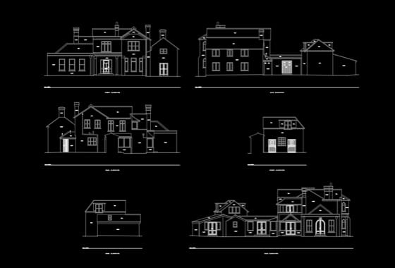
A measured survey differs from a topographical survey in that it’s a survey of the structure, services, and external and internal features of a building, or collection of buildings.
A measured survey is used for various purposes: to evaluate the property for sale or leasing, to plan internal spaces, and to provide a starting point for refurbishment or redevelopment for architects and property professionals.
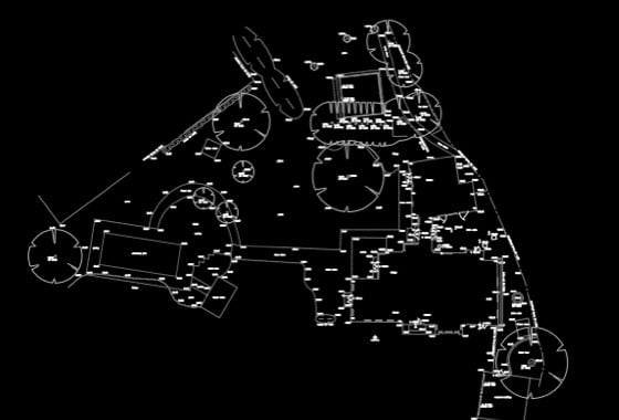
Putting it in simple terms, a topographical survey relates to land (bottom image) while a measured survey relates to buildings (below).
Measured Building Example:

Topographical Land Example:

In many development projects, both surveys are required. For example, when designing a new extension, planners need the surrounding land conditions (topographical survey) and the accurate internal layout of the existing structure (measured survey) to coordinate levels, access, and structure.
XP Surveys provides both services in-house, allowing for seamless coordination between the land and building data. This is especially useful in projects involving sloped sites, access changes, or heritage structures where both land and structure data are critical.
Looking for a quote for a topographical survey? At XP Surveys, we provide precise and cost-effective topographical surveys for construction, land development, and infrastructure projects. Our experienced surveyors use cutting-edge technology to deliver detailed site data, ensuring your project runs smoothly.
Whether you need boundary mapping, elevation data, or utility surveys, we tailor our services to meet your specific requirements. Get a quick, competitive quote for a topographical survey today and benefit from our professional expertise.
Contact us now for a free consultation and receive a detailed proposal outlining costs, timelines, and survey specifications.

A topographical survey helps professionals understand a site’s existing conditions. It is used to assess feasibility, support planning applications, and inform site design decisions by identifying levels, boundaries, drainage paths, and any constraints on the land.
A professionally conducted topo survey can achieve accuracy within millimetres. At XP Surveys, we use advanced instruments like 3D laser scanners and total stations to ensure high precision across every project.
We provide topographical surveys throughout Greater London and the Home Counties, including Surrey, Essex, Kent, Hertfordshire, and beyond.
A topographical survey provides detailed elevation and surface feature data, while a land registry plan simply outlines legal property boundaries, often with far less accuracy.
Yes. We can generate 3D topographic models suitable for BIM workflows or visualisations in Revit or ArchiCAD, depending on your requirements.
We use Area data from your property's EPC certificate and the UK Ordnance Survey database to calculate your quote estimate. If there is not enough data in the UK database we cannot provide an instant quote, but one of our team will be able to provide a formal written quote by email within 48 working hours. If the database holds incorrect data on your property you will still be provided an estimate, but our fee is subject to change to suit the actual size of your property
Your chosen outputs:
"I have found incredible flexibility and helpfulness in the XP Surveys team. In my last 10 professional years, I have rarely found a business, surveyors or otherwise, to be as useful, approachable and competitive as them. It helps provide confidence to myself and my clients alike."


A member of the XP Surveys team will be in touch shortly
Or call 0333 335 5085
Or call 0333 335 5085
Or call 0333 335 5085