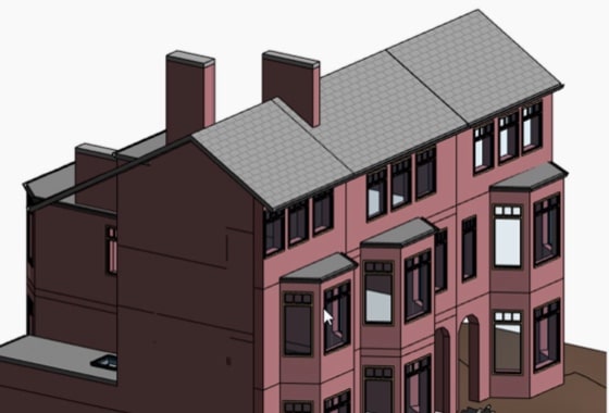
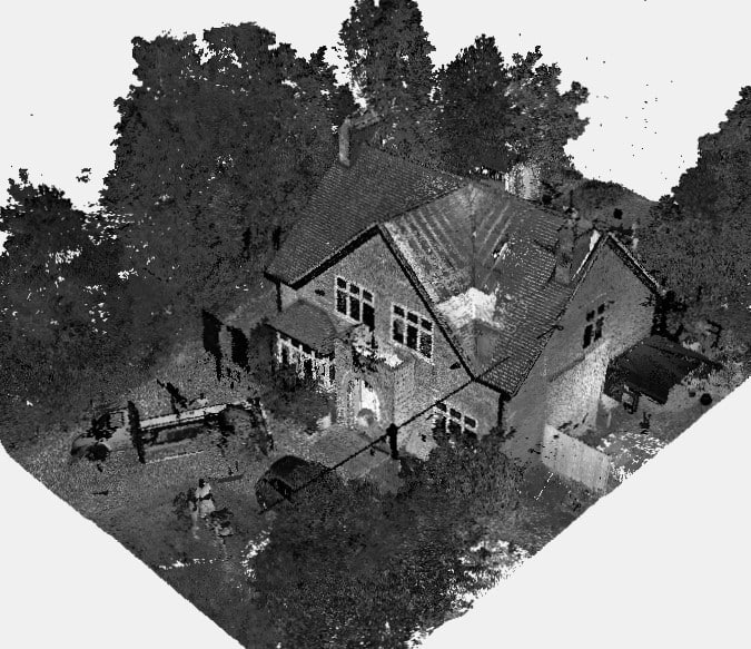
We will survey all accessible floors in the property and provide plans showing all visible walls, windows, doors, spot height levels, ceiling/roof heights, window sill/head heights.
Maintaining a property’s roof can be costly, especially when traditional inspection methods involve scaffolding, extended timelines, and hefty labour charges. However, drone roof surveys are transforming how property owners approach roof assessments — offering a faster, safer, and more cost-effective solution.
Unlike measured surveys, drone roof surveys are imagery-only assessments. They capture high-resolution aerial images of your roof to document condition, highlight damage, and support planning or maintenance decisions. Ideal for property owners needing a visual overview, drone roof surveys eliminate the need for physical roof access or structural intervention.
Whether you’re a homeowner, landlord, or property manager, here’s how using drones for roof inspections can save you both time and money — without compromising on insight.
Why Property Owners Use Drone Roof Surveys
1. Visual Roof Inspection with Drones: What’s Captured and Why It Matters
A roof inspection with drones involves capturing detailed aerial photos or videos of your roof from multiple angles. These visuals can reveal:
- Broken or missing tiles
- Blocked gutters or drainage
- Chimney damage
- Moss, debris, or water pooling
- General wear and tear
Because the output is visual, property owners can assess overall roof condition without guesswork — or costly surprises.

2. Faster and Safer Than Manual Roof Access
Accessing a roof traditionally requires scaffolding, ladders, or cherry pickers — which are time-intensive and risky. Drone surveys are completed from ground level by a licensed operator, removing the health and safety risks entirely. Inspections that once took days now take under an hour.
3. No Measurements – Just Clear Aerial Imagery
These surveys are imagery-only, meaning they don’t involve LiDAR, point cloud scanning, or manual tape measurements. They’re ideal for visual condition checks, not for architectural drawings or planning submissions.
4. When Imagery is Sufficient — and When It’s Not
Drone roof inspections are perfect when:
- You need a maintenance check
- You’re reviewing damage after a storm
- You’re preparing for roof repairs or quotes
However, for structural assessments, architectural design, or planning applications, a measured building survey may be more appropriate.
How Drone Roof Inspections Work (Imagery-Focused Process)

1. Booking Your Drone Inspection
Booking is easy with services like XP Surveys’ online quote system. Enter your postcode, describe your property, and choose a time that suits you.
2. Preparing the Site
Before survey day:
- Ensure drone access above the property
- Be aware of nearby trees, wires, or flight restrictions
- Monitor weather (drones can’t fly in high winds or rain)
The surveyor handles CAA permissions and legal compliance.
3. Capturing High-Resolution Aerial Imagery
The drone captures multiple angles and close-ups of the entire roof, gutters, chimneys, and surrounding features — all in ultra-high resolution.
4. What’s Included (and What’s Not)
| Included | Not Included |
| Aerial photography/video | Laser scanning |
| Annotated images | Roof measurements |
| Commentary on visible defects | CAD drawings or models |
5. Delivery of Results
Expect a set of annotated images and visual commentary, typically within a few days. Some services offer follow-up consultations to review findings.
Key Benefits of Imagery-Only Drone Roof Surveys
- Rapid Turnaround. Great for time-sensitive repairs
- Cost-Efficient. No scaffolding, no high-access costs
- Minimal Disruption. No need to access the roof or disturb tenants
- Professional Documentation. Useful for insurance or future maintenance
Frequently Asked Questions
1. How Much Does a Drone Roof Survey Cost?
Drone roof inspection costs vary depending on property size and location. For many UK properties, prices start from around £150–£300 + VAT. Use XP Surveys’ Instant Quote tool for tailored pricing.
2. What Detail Does the Imagery Provide?
The survey provides high-resolution visuals of the entire roof surface, flashing, chimneys, and drainage. While it doesn’t include measurements, it gives a clear, zoomable view of any visible defects.
3. When Should I Not Use a Drone Roof Inspection?
Avoid drone-only surveys if you require:
- Precise roof measurements
- Slope or pitch data
- Structural assessment
- Planning application-ready drawings
In these cases, a measured building survey is a better fit.
4. Can I Use This Survey for Insurance or Maintenance?
Absolutely. The visuals provide clear, timestamped evidence of roof condition, ideal for insurance claims or planned maintenance works.
5. Are Drone Surveys Legal and Insured?
Yes. Reputable providers like XP Surveys use CAA-approved pilots and operate with full liability insurance.
Who Should Use Imagery-Only Drone Surveys
These surveys are particularly useful for:
- Homeowners checking roof condition before or after repairs
- Property managers maintaining multiple assets efficiently
- Surveyors or tradespeople quoting for work remotely
- Landlords reviewing conditions across multiple tenancies
The Limitations of Drone Roof Surveys (Set Clear Expectations)
- No dimensional data: No roof measurements or pitch info
- Not a structural report: Cannot confirm roof integrity
- Not valid for planning: Doesn’t meet requirements for measured drawings
- Weather & permissions: Drones cannot fly in poor weather or restricted airspace
How to Use Drone Imagery Effectively
Reviewing Your Images: What to Look For
- Cracks or damage in tiles or flashing
- Blocked or rusted gutters
- Vegetation or moss growth
- Chimney or vent issues
Sharing with Professionals
Share the imagery with:
- Roofing contractors (for quotes)
- Insurance companies (for claims)
- Surveyors (to identify further inspections needed)
Combining with Other Surveys
Drone imagery often works best when combined with a measured building survey — giving you both visual insight and technical data for comprehensive property planning.
Conclusion & Call to Action
Drone roof surveys offer property owners a smarter way to inspect roofs — saving time, reducing costs, and removing risk. They’re best suited for visual-only condition assessments and serve as a highly effective first step in property maintenance or project planning.
To book your drone roof survey or get an instant quote, visit XP Surveys’ Drone Survey page today.


