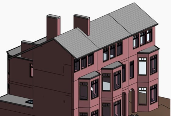
We will survey all accessible floors in the property and provide plans showing all visible walls, windows, doors, spot height levels, ceiling/roof heights, window sill/head heights.

Why Accuracy Matters in Land and Site Surveys
Accuracy is critical in:
- Defining boundaries
- Planning construction layouts
- Conducting topographic mapping
- Calculating volumetrics
Errors in surveys can result in planning delays, legal disputes, and expensive rework. Understanding how traditional surveying methods stack up against drone survey services is essential for informed decision-making.
Comparing Accuracy: Drone Imagery vs Traditional Surveying
Defining Accuracy: RMSE & Tolerance Levels
Survey accuracy is typically measured using Root Mean Square Error (RMSE) and defined tolerance thresholds. Precision requirements can range from centimetres to millimetres depending on project scope.
Traditional Methods: Total Station & GNSS
- Total stations provide sub-centimetre precision through optical and electronic distance measurements.
- GNSS (Global Navigation Satellite Systems), with dual-frequency receivers and corrections, can achieve centimetre-level accuracy under optimal conditions.
These methods, when employed by a professional surveyor, consistently deliver high precision, making them the standard for legal and engineering-grade surveys.
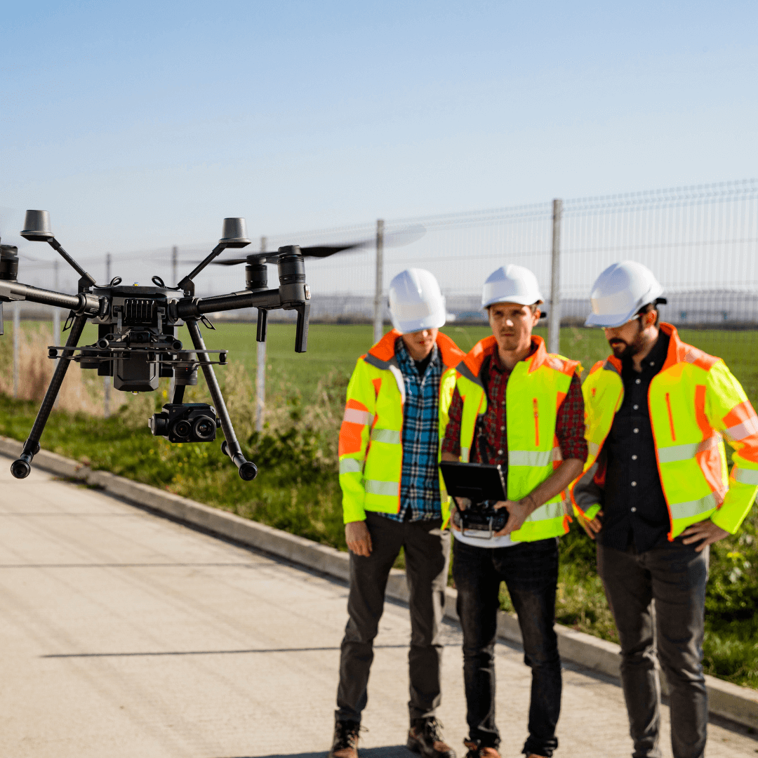
Drone Surveys with GCP, RTK/PPK
Modern drones equipped with:
- Ground Control Points (GCP)
- RTK/PPK GPS correction systems
- High-resolution cameras
can achieve accuracy levels within 3–5 cm, and in controlled environments, can even approach millimetre precision.

Photogrammetry vs LiDAR: Strengths & Limits
| Photogrammetry | LiDAR | |
| Vegetation Penetration | Limited | Excellent |
| Surface Detail | High‑resolution imagery | High point density, less visual |
| Accuracy in Vegetated Terrain | GCP needed for ground accuracy | Consistently accurate |
| Equipment & Processing Costs | Lower | Higher |
Speed & Site Coverage: Aerial Drone vs Traditional Survey
- Drones can survey large areas rapidly, often covering hundreds of acres per day.
- Traditional methods, involving total stations and manual setup, are far more time-consuming, potentially taking weeks for the same coverage.
- While drones significantly cut field time, processing and validating drone data (e.g., point cloud cleaning) requires expertise, though it is faster overall than manual data collection.
Cost Comparison: Drone Surveying vs Traditional Techniques
Drone surveys often prove more cost-effective due to:
- Reduced manpower and less heavy equipment.
- Faster field data collection, lowering per-project labour costs.
- Ideal cost savings for repetitive, large-area surveys (e.g., agriculture, stockpiles).
However, consider the Total Cost of Ownership (TCO) if investing in a drone platform, which includes hardware, software, and training.
Safety & Accessibility: Site Conditions Compared
Deploying drones enhances safety by:
- Reducing the need for personnel to access dangerous or hard-to-reach areas.
- Enabling surveys in hazardous environments like unstable ground, steep slopes, or active construction sites.
- Operating in remote locations without the logistical complexity of manual surveys.
However, drone use involves navigating privacy laws and obtaining airspace permissions, which can impact scheduling.
Data Types & Deliverables: What You Get with Each Method
Traditional Surveying Methods:
- High-precision point measurements
- Accurate linework drawings
- Essential for legal boundary documentation and detailed engineering tasks.
Drone Survey Deliverables:
- High-resolution orthomosaic maps
- Digital Surface Models (DSM) / Digital Terrain Models (DTM)
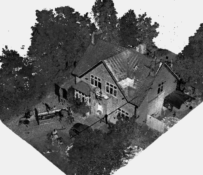
- Dense point clouds
- Detailed 3D models
- Volumetric analysis reports
- Infrared imaging and BIM-ready files for integration into CAD workflows.

Limitations & When to Choose Hybrid Methods
While drones offer significant advantages, limitations include:
- Weather dependency (e.g., wind, rain).
- Battery life constraints on larger projects.
- Airspace restrictions near airports or urban areas.
- Photogrammetry struggles in dense vegetation unless supplemented by LiDAR.
For projects requiring absolute ground accuracy, combining drone data with ground control verification or total station measurements provides a balanced solution.
Practical Use Cases: Drone Imagery for Land Analysis
Drone imagery is increasingly used in:
- Topographic site surveys
- Architectural site surveys
- Construction progress monitoring
- Stockpile volume assessments
- Agricultural mapping
- Environmental impact surveys
Its ability to generate accurate, visual-rich data quickly makes it invaluable for site assessments and project planning.
ROI: Can Drone Surveys Replace Traditional Surveying?
While drone surveys offer superior efficiency and cost benefits, they do not entirely replace traditional methods. Here’s when to use each:
| Scenario | Best Method |
| Legal boundary certification | Traditional survey methods |
| Large, open area mapping | Drone survey |
| Dense vegetation or obstructed terrain | Drone with LiDAR or hybrid |
| Urban, airspace-restricted areas | Traditional survey methods |
| High-volume stockpile monitoring | Drone survey |
Surveyor Recommendations
Professional surveyors advocate for a combined approach, using drone surveys for rapid data acquisition and traditional methods for spot-checking and verifying critical measurements.
FAQ
Is drone surveying more accurate than traditional survey?
Not in all cases. Drones can achieve <5 cm accuracy with the right setup, but traditional methods still lead in sub-centimetre precision.
Can drone surveys be used for legal land boundaries?
Not solely. Ground-based verification is needed for legal certifications.
What affects drone survey accuracy?
Factors include GCP placement, GPS signal quality, sensor resolution, and environmental conditions.
How long does a drone survey take compared to traditional methods?
Drone surveys can reduce field time from weeks to days, with post-processing required.
Do drones replace surveyors?
No. Drones enhance a surveyor’s capabilities but professional expertise remains essential for data validation, interpretation, and compliance.
Conclusion & Expert Recommendations
Drones have transformed site surveying, offering fast, cost-effective and safe data collection. However, traditional surveying methods remain indispensable for applications demanding the highest precision, especially for legal or engineering certification.
At XP Surveys, we provide a hybrid service — combining advanced drone technology with the precision of traditional methods to ensure you receive the most accurate data for your project. For expert advice or a tailored quote, call 0333 335 5085 or get an instant quote online.


